It’s easy to explore Alderney on foot. From rugged cliff paths carpeted with gorse and wildflowers to quiet sandy bays. We stepped out and enjoyed the island at our own pace with our self-guided walks, all of which are free to pick up from the Visitor Information Centre.
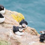
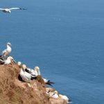
This is a hugely varied coastal route passing most of the island’s fortifications and wildlife wonders. It mostly follows the well-marked coastal path but occasionally uses steep, rougher paths, particularly on the island’s eastern tip, to get a good view of the gannet colonies.
ROUTE DETAILS
Start at the Alderney Quay next to the ferry terminal, turn right and walk beneath the Alderney Sailing Club and exit the harbour via the tarmac ramp, turn left, then immediately right onto Route de Crabby, passing the boatyard buildings on your right. Walk along the roadside path around Crabby Bay towards Fort Doyle. After passing the first ‘Coast Path’ sign (Braye 9.7; Braye 0.3 miles), continue around Saline Bay on the gravel track past Fort Platte.
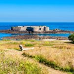
After meeting the ‘main’ road at the head of Saline Bay, take the right-hand lane keeping to the coastline with the fort above you to your left. Follow the tarmac road and then gravel track. Continue along the gravel track to reach Fort Clonque.
Fort Clonque is the second largest fort on the island and is easily accessible with plenty of interpretation.
Climb the zig-zag path above Fort Clonque, following the coast path route.
Enjoy the great views of Berhou Island. After a short time, on a sharp left bend marked by a blue bench, you’ll see the guide ropes leading steeply downhill to an underground bunker. The route (now leaving the official coastal path) passes right, over the top of the bunker, on a faint path parallel to the coast along the coastline.
Walk down into the valley and then up the other side, keeping to the right fork when you meet another path halfway up the hill. Continue around the headland and descend sharply into the Vallee des Trois Vaux. On the rough ascent out of the valley, there is a lot of erosion close to the cliff edge, so find a route away from the edge.
From Telegraph Tower onwards
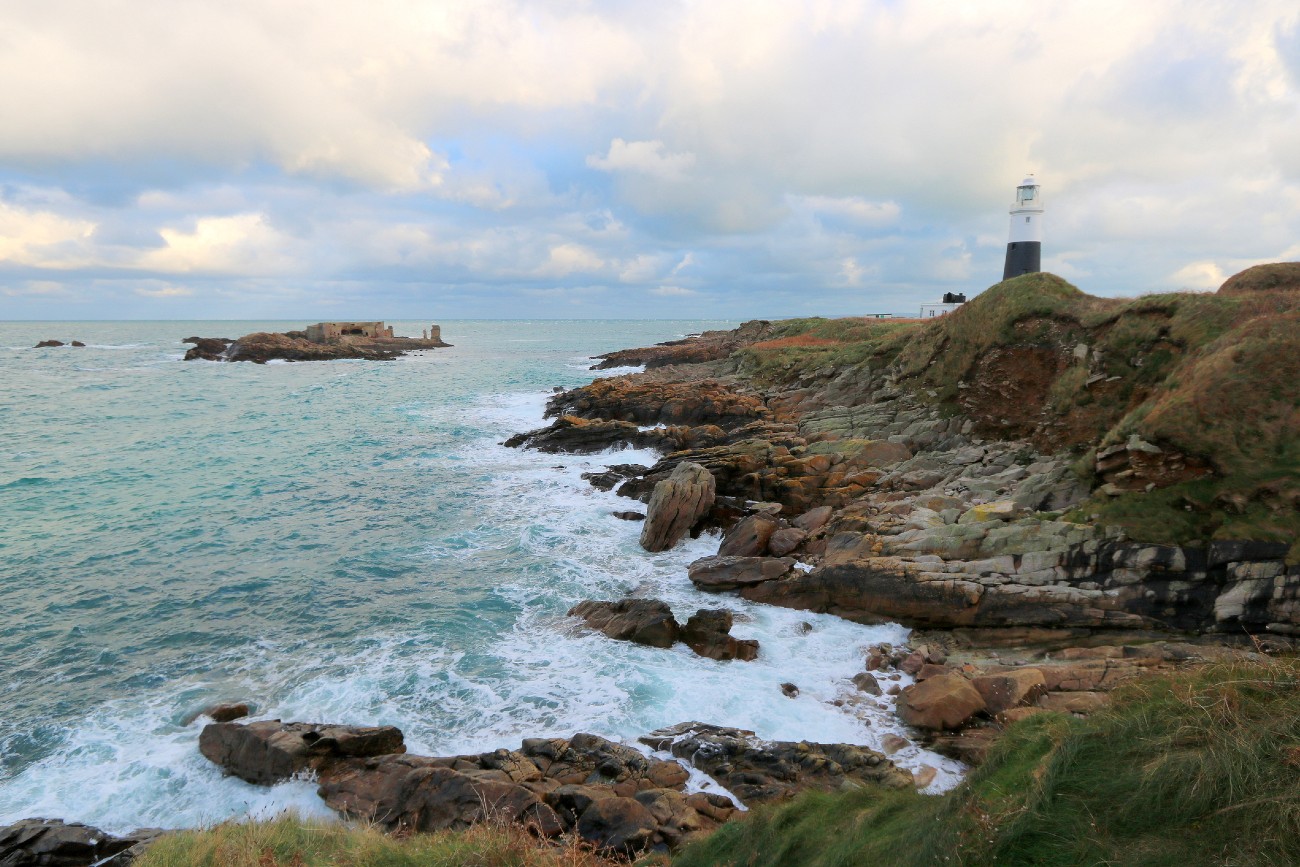
At the top of the climb, walk towards Telegraph Tower and then take the grassy path that takes you to the right of the tower. Continue taking the small grassy paths that keep you closest to the coast around Telegraph Bay. Then, passing the Tower on your left, reaching a junction with the gravel track (marked as the main road on the OS map), follow the coast path markers and turn right towards the coast. After a short time on the track, cross over the streamway (maybe dry) and walk uphill. Before the top of the hill, take the faint path on the right marked by a small white-painted stone—good views behind you to the airport’s runway.
Follow the painted white rocks along the clifftop. After 10mins or so, you’ll reach the coast path again marked with a standing stone and a coast path sign. Turn right towards the large house on the hill. At this point, there is a direct route back to St Anne if needed. Head downwards through the sycamore trees and then uphill to reach the Wildlife Bunker just before the large house.
This converted bunker is a great place to stop to learn more about the island’s wildlife and its military history.
Explore other activities in Alderney! Don’t miss the following article: Scuba Diving around Renonquet and Ortac Reef in Alderney